What to remember
- Ainu names for rivers, slopes and mountains sit under the farm map of Furano and Biei, so the landscape reads as two layers at once.
- Farm Tomita covers 29 hectares and welcomes over a million tourists annually, with lavender blooming from late June to mid-August.[1][2]
- The Shirogane Blue Pond appeared after the December 1988 eruption of Mount Tokachi, and the peak above it is 2,077 meters high.[3][4]
- Furano is about a two hour drive from Sapporo using the Doo Expressway between Sapporo and Mikasa, which is why most visitors do it as a day trip.[5]
- Furano's population is approximately 26,000 including the outskirts, with about 16,000 in the main municipal area.[6]
- Top choice Furano & Biei flower day from US$48 Rating4.56 from 122 reviews[7]Duration1 day[7]Route highlightsBlue Pond, Shikisai No Oka, Farm TomitaCancellationFree cancellation up to 24 hours ahead[7] Check availability
- Cape Kamui & Otaru trip from US$56 Rating4.55 from 87 reviews[8]Duration10 hours[8]Route highlightsCape Kamui, Otaru Canal, Shiroikoibito ParkCancellationFree cancellation up to 24 hours ahead[8] See this tour
- Biei flower sea tour from US$43 Rating4.76 from 51 reviews[9]Duration10 hours[9]Route highlightsBiei, Furano, Shikisai No Oka, Farm TomitaCancellationFree cancellation up to 24 hours ahead[9] See this tour
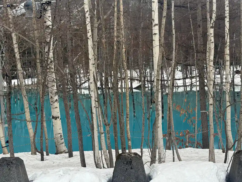
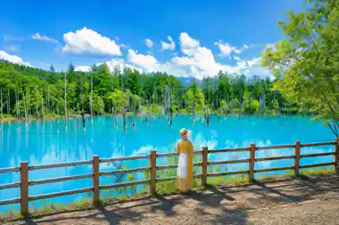
The December 1988 eruption sent volcanic mudflows down the Biei River, forcing emergency erosion-control dams whose backed-up water became the pond.
Furano's European look: worth a day of your Hokkaido trip
Getting there and around
Furano and Biei: reading the Ainu landscape
Hokkaido on Japan's map is the northern island, the broad one that reaches up towards Sakhalin, and Furano sits roughly in its centre. Place names are the quickest way into the island's older history. Furano, Biei, Kamui, Tokachi and many smaller places carry Ainu words inside them, often describing a river, a slope, a colour of water or the way the ground lies. The Hokkaido Ainu people knew these valleys by how the land behaved rather than by lot numbers.
Stand in the middle of the Furano basin and you can still feel that older shape under the fields. The valley floor is flat and farmed, wooded ridges rise on either side, and the Daisetsuzan volcanoes close the view at the far end. Biei, a short run north, is gentler: rolling hills, farm roads that follow the contours, and small woods between the fields. The Ainu names in this part of Hokkaido keep coming back to water, to rivers that flood, springs that stay cold all year, and ponds whose colour shifts with the light.
Ainu place names survive in a landscape that has been renamed twice over: once into Japanese, and once into the practical language of plots, bridges and road numbers. Read both layers together and the valley stops looking like a blank northern prairie and starts looking like a place with a long memory.
The Meiji era: opening the Hokkaido frontier
The farm landscape you see today is a much newer layer. During the Meiji era the government set out to settle and farm Hokkaido, treating the island as a frontier to be measured, divided and roaded. Surveyors laid out long grid roads through the flat river valleys, land was allotted, forest was cleared, and settlers arrived from Honshu and from other parts of Japan. Furano and Biei grew into agricultural districts rather than resource outposts.
That planning still shows in the land. Farm roads in the Furano basin run straight where the ground allows, with plots of a similar size on either side, and shelterbelts planted in rows to break the wind. Over in Biei, the area around the Seven Stars Tree is known as Patchwork Road, where different crops are planted in each plot, forming the scenery the town is known for.[11] Farmhouses and barns stand between the fields, and the colours shift through the growing season.
The result reads as planned rather than grown, with long sightlines and few surprises. Nothing about it is accidental, from the angle of the roads to the spacing of the windbreaks, and that deliberate quality is part of what makes the scenery feel imported.
Painted barns, straight farm roads and a volcano on the skyline: the Furano basin in summer.
American influence: Sapporo Agricultural College and its advisers
A second imported layer came through education rather than legislation. Sapporo Agricultural College, founded in the northern capital in the early Meiji years, was staffed in its first years by American teachers and advisers. One of them, William S. Clark, is remembered across Hokkaido, and his stay in Sapporo is still part of local storytelling. Students carried what they learned back to farms around the island.
What those teachers brought was practical: soils, field crops, animal husbandry and dairy work. English-language textbooks, unfamiliar machinery and new crops arrived with them. Hokkaido's farming grew up around a blend of Japanese practice and imported northern European and North American methods, and the buildings that came with it followed the same mixture.
The college also gave the region a habit of looking outward for methods, stock and seed, and that habit outlasted its early decades. Sapporo itself carries the same imprint, with a city centre laid out on a grid and a dairy and confectionery trade built on Hokkaido milk and wheat. The countryside around Furano took the parts that suited the land: pasture, mixed cropping, and a barn in every second view.
Why barns and silos define the Furano landscape
Furano's farm buildings are where the imported look is easiest to see. Barns and silos arrived with dairy and mixed farming, and their shapes are recognisably imported: a long pitched roof over a wide door, a tall cylinder beside it, painted red or white and set at the corner of a field. Put a few of those among the wheat and the view reads as American or northern European rather than Japanese.
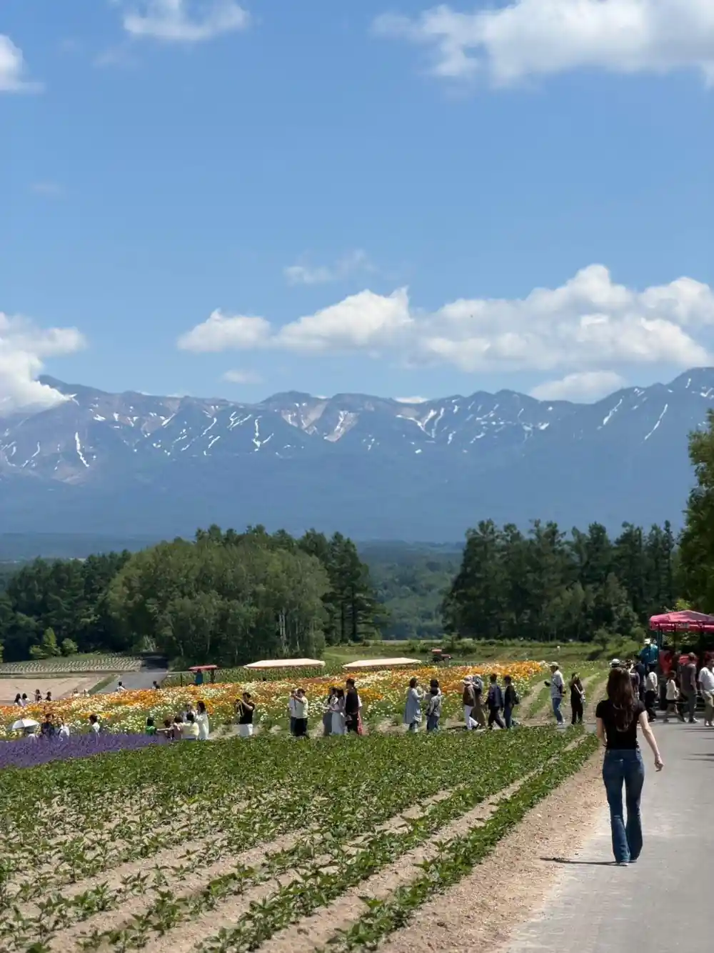
Field size matters just as much. Shikisai-no-oka spreads across fifteen hectares of Biei hillside.[12] Big fields and machinery go together, and the result is a landscape of wide views, low boundaries and few hedges, with nothing taller than a windbreak between you and the volcano. Seen from the farm roads, Biei's patchwork hills run through bands of golden wheat, purple potato flowers, green bean fields and brown plowed earth.[13]
Add the light. In Hokkaido it stays bright late into summer evenings and comes in low and long in winter, flattering painted wood, gravel yards and rows of flowers. Photographers tend to notice that before they notice anything else about the place.
from US$48
Runs for 1 day from two starting location options, with stops at the blue pond, Shikisai No Oka and Farm Tomita, from US$48[7].
Population and geography: why Hokkaido stayed sparse
Furano is a small town inside a large landscape. Its population is approximately 26,000 including the incorporated communities in the outskirts, and the main municipal area is said to be about 16,000.[6] You notice it on the road: built-up stretches are short, and fields, forest and sky fill most of the distance between them. The next town can be a long drive away.
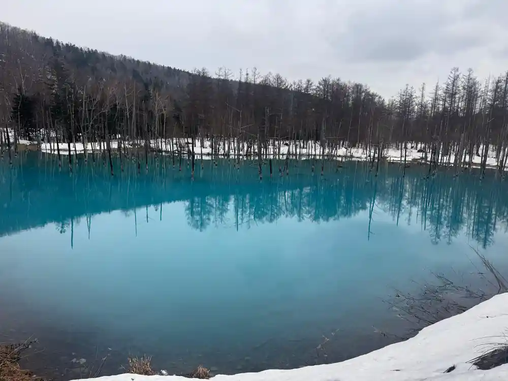
The land keeps places apart. Mount Tokachi is 2,077 meters high.[4] Its volcanic past is still written along the rivers: the Shirogane Blue Pond was created when emergency erosion-control dams backed up water after the December 1988 eruption of Mount Tokachi, and it appears blue because suspended aluminium colloids scatter light.[3] Close by, groundwater seeping from the rock face plunges about 30 metres to the river at Shirahige Waterfall.[14]
Forest covers much of the region, and farming sits in the flatter pockets where roads and rivers allow it. Small towns spaced far apart, ringed by trees and fields, are what give this part of Hokkaido its open, lightly peopled feel on the ground as well as on the map.
From farm station to Japan's Provence
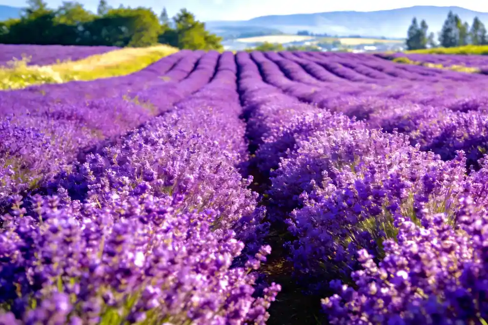
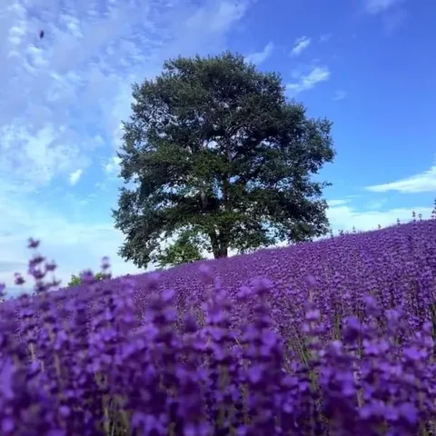
Furano's flower reputation grew out of a farm crop. Lavender has been cultivated in Hokkaido since the 1940s.[15] It was planted for oil, and visitors followed the fields. Farm Tomita covers 29 hectares and welcomes over a million tourists annually.[1] Seed packets, lavender ice cream and drying racks now sit alongside the farm equipment.
Timing decides what you see. Lavender starts blooming from late June to mid-August.[2] Summer here is gentle rather than hot: the average temperature in Furano in July is 22.1°C.[10] Winter is a different country again. Reported records for one season put Furano's cumulative snowfall at 158 cm in the first two weeks of December, on top of 45 cm that fell in November.[16]
The grower's calendar runs underneath the visitor's calendar. Cutting, drying and distilling carry on while the fields are still open, and the hillsides change colour week by week from the first purple rows to the last of the summer green.
Planning your visit to Furano's historical landscape
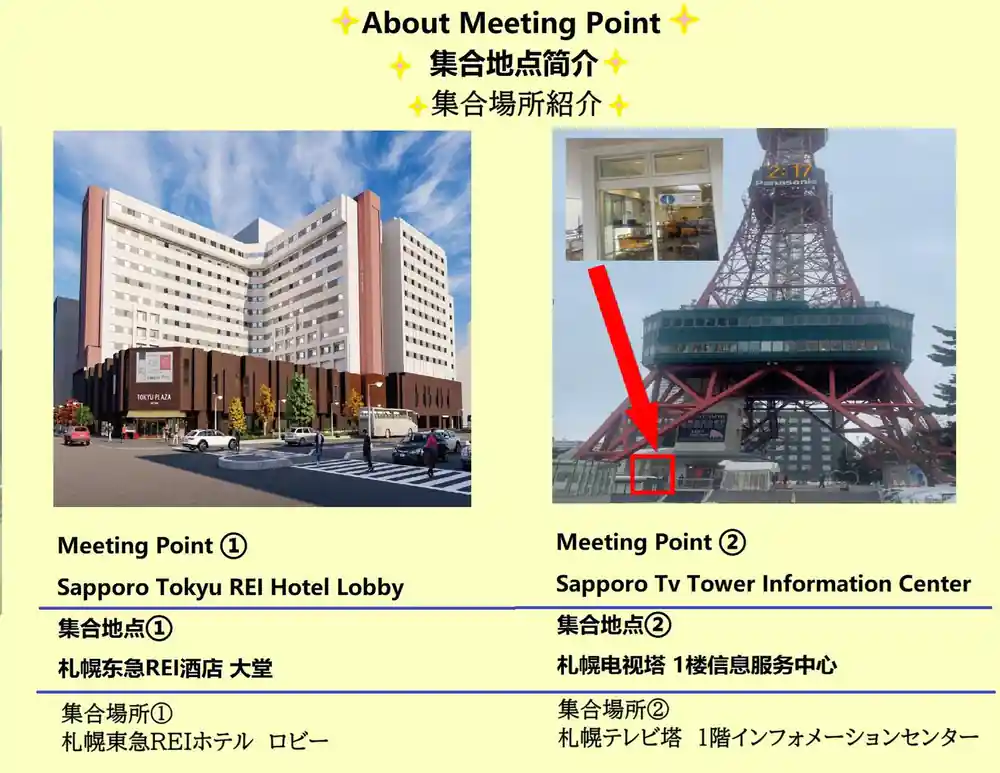
Furano is about a two hour drive from Sapporo using the Doo Expressway between Sapporo and Mikasa.[5] Most people with limited time do it as a day trip, and the coach tours from Sapporo follow the same route. The Colored Hokkaido: Furano Flower&Biei Blue Pond tour lasts 1 day, has two starting location options, and stops at Patchwork Road, the Shirogane Blue Pond, Shikisai No Oka, a local restaurant and Farm Tomita, with a live tour guide in English, Chinese, Japanese and Korean.[7]
If you drive yourself, the same stops work in almost any order, and you can add Ningle Terrace, the wood-cabin shopping area in the green forest of Furano, where the shops are lit up after sunset.[17] On the Biei side the patchwork views shift with every bend of the farm roads.[13] Keep some time free at the end of the day for the run back to Sapporo.
Book ahead for the lavender weeks, when the flower fields around Furano and Biei fill up. Reserve now and pay later is available on the day tour, and free cancellation applies up to 24 hours in advance for a full refund.[7] Plan on a full day out of the city.
From prices for Sapporo day tours reaching Furano and Biei
Each value is a from price taken from a GetYourGuide listing.[7][8][9][18]
Compare day tour from prices
Amounts are from prices in US dollars from GetYourGuide listings.[7][8][9][18]
When to go to Furano and Biei
Reading the landscape
Start with the names
Ainu place names mark rivers, slopes and springs across Hokkaido, and they are the oldest layer you can still read on a map.
Notice the straight roads
Meiji-era survey work left long grid roads and windbreaks in the flat valleys, and Furano's farm blocks still run in tidy rectangles.
Look for the barns
Pitched roofs, painted boards and tall silos sit at field corners across the valley, a farm style that arrived with dairy and mixed cropping.
Follow the flowers
Farm Tomita covers 29 hectares and lavender blooming runs from late June to mid-August.[1][2]
End at the blue water
The Shirogane Blue Pond formed after the December 1988 eruption of Mount Tokachi; aluminium colloids scatter light.[3]
Plan the drive
Furano is about a two hour drive from Sapporo on the Doo Expressway, or a coach day tour from the city.[5]
See Furano's flower fields and the blue pond on a day trip from Sapporo
from US$48Reserve now & pay later